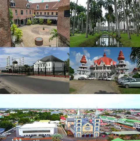
Paramaribo →
Compare Paramaribo for seasonal weather, housing and everyday journeys. Open its guide for the local introduction, monthly climate and sources.

Explore the country
Suriname provides national context for a visit or move. Read its sourced introduction and dated national indicators, then compare individual cities for seasonal weather, housing and daily journeys. National averages cannot establish the costs, services or conditions of a particular neighbourhood.
Compare relocation preferencesSuriname, officially the Republic of Suriname, is a country on the northern coast of South America, also considered part of the Caribbean region. Situated slightly north of the equator, over 90% of its territory is covered by rainforest, the second-highest proportion of forest cover in the world. Suriname is bordered by the Atlantic Ocean to the north, French Guiana to the east, Brazil to the south, and Guyana to the west. It is the smallest sovereign country in South America by both population and territory, with around 612,985 inhabitants in 2021 in an area of approximately 165,940 square kilometres . The capital and largest city is Paramaribo, which is home to roughly half the population. Suriname was inhabited as early as the fourth millennium BC by various Indigenous peoples, including the Lokono, Kalina, and Wayana. Europeans arrived and contested the area in the 16th century, with the Dutch controlling much of the country's current territory by the late 17th century.
Compare Paramaribo for seasonal weather, housing and everyday journeys. Open its guide for the local introduction, monthly climate and sources.
National averages are a starting point, not a neighbourhood budget. Shortlist specific places in Suriname, compare housing for your dates and check the journey to work, school or the activities that matter to you.
For a move, confirm residence and work requirements with the relevant government authority for your nationality. For a holiday, compare transport, accommodation and daily spending separately.
These figures describe Suriname as a whole. Check the dates when comparing these national indicators with current local conditions.
40 ordinal_0_100
Data period: 2026-08-30. Limited confidence. Source: Wikidata — coordinates, population, timezone, ISO codes, official languages · CC0 1.0Compare with another city →15.7 µg/m³
Data period: 2023. Limited confidence. Source: World Bank — PM2.5 mean annual exposure (EN.ATM.PM25.MC.M3) · CC BY 4.0 with World Bank additional termsCompare with another city →55.7 (EU average = 100)
Data period: 2025. Limited confidence. Source: World Bank — Price level index, household consumption (PA.NUS.PRVT.PLI) · CC BY 4.0 with World Bank additional termsCompare with another city →21,000 international dollars (PPP)
Purchasing-power-adjusted national income per person is not a salary or take-home pay.
Data period: 2025. Source: World Bank — GNI per capita, PPP (NY.GNP.PCAP.PP.CD) · CC BY 4.0 with World Bank additional termsCompare with another city →6.5 per 100,000 people
Homicide rates are a narrow safety indicator. They do not describe petty crime or the safety of an individual neighbourhood.
Data period: 2023. Source: World Bank / UNODC — Intentional homicides per 100k (VC.IHR.PSRC.P5) · CC BY 4.0 with World Bank additional termsCompare with another city →87.4 percent
Data period: 2023. Source: World Bank / ITU — Individuals using the Internet, % (IT.NET.USER.ZS) · CC BY 4.0 with World Bank additional termsCompare with another city →73.8 years
Life expectancy describes population health outcomes; it does not measure the quality or availability of a particular hospital.
Data period: 2024. Source: World Bank — Life expectancy at birth (SP.DYN.LE00.IN) · CC BY 4.0 with World Bank additional termsCompare with another city →